
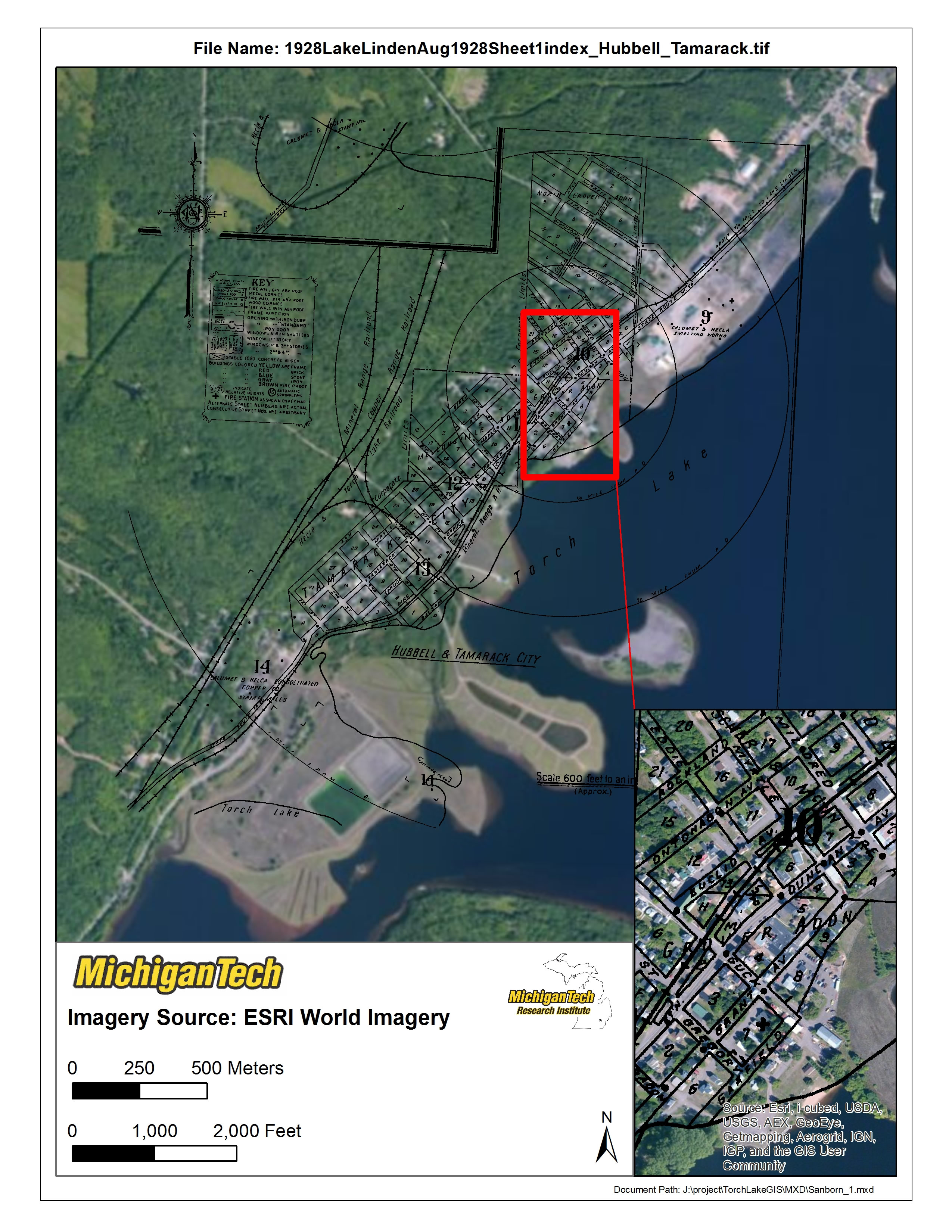
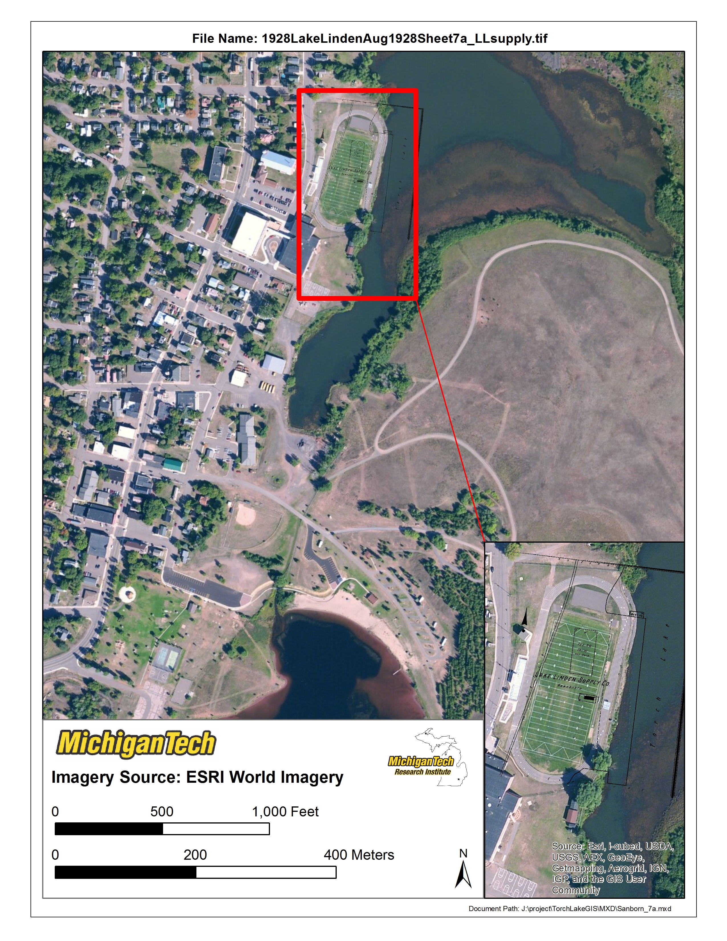
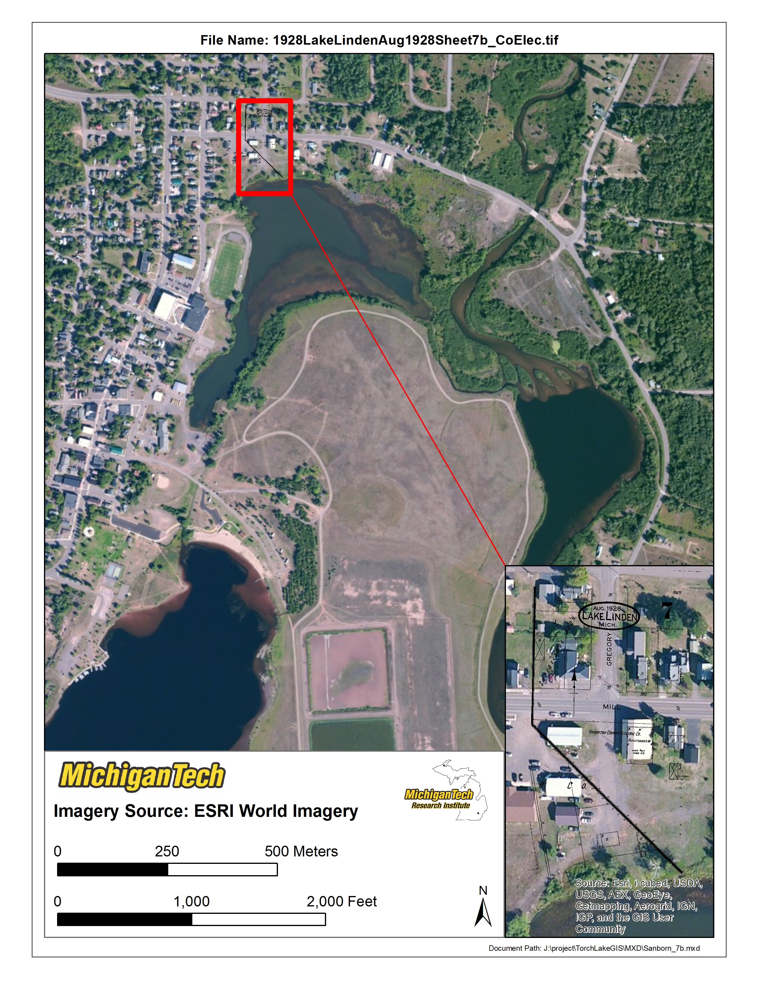
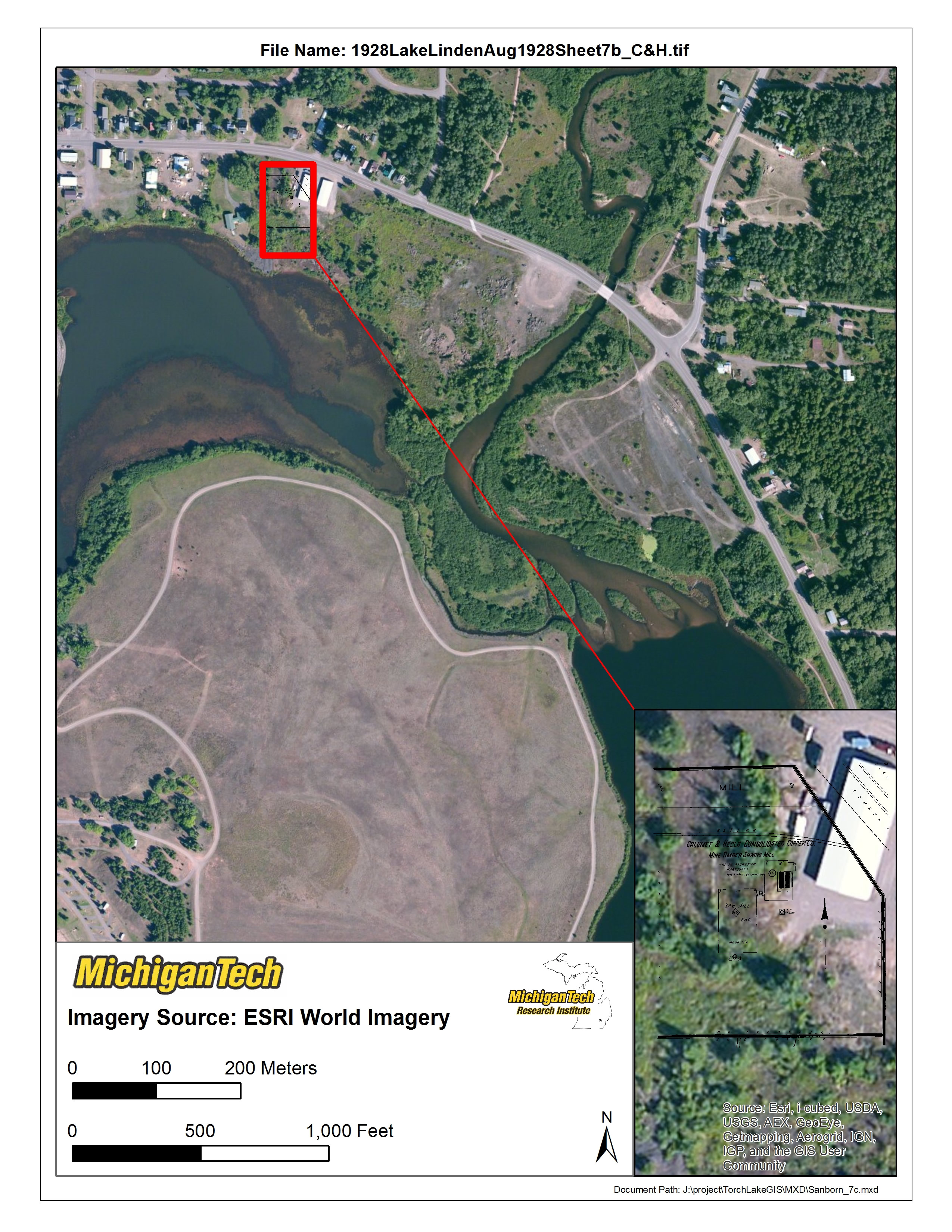
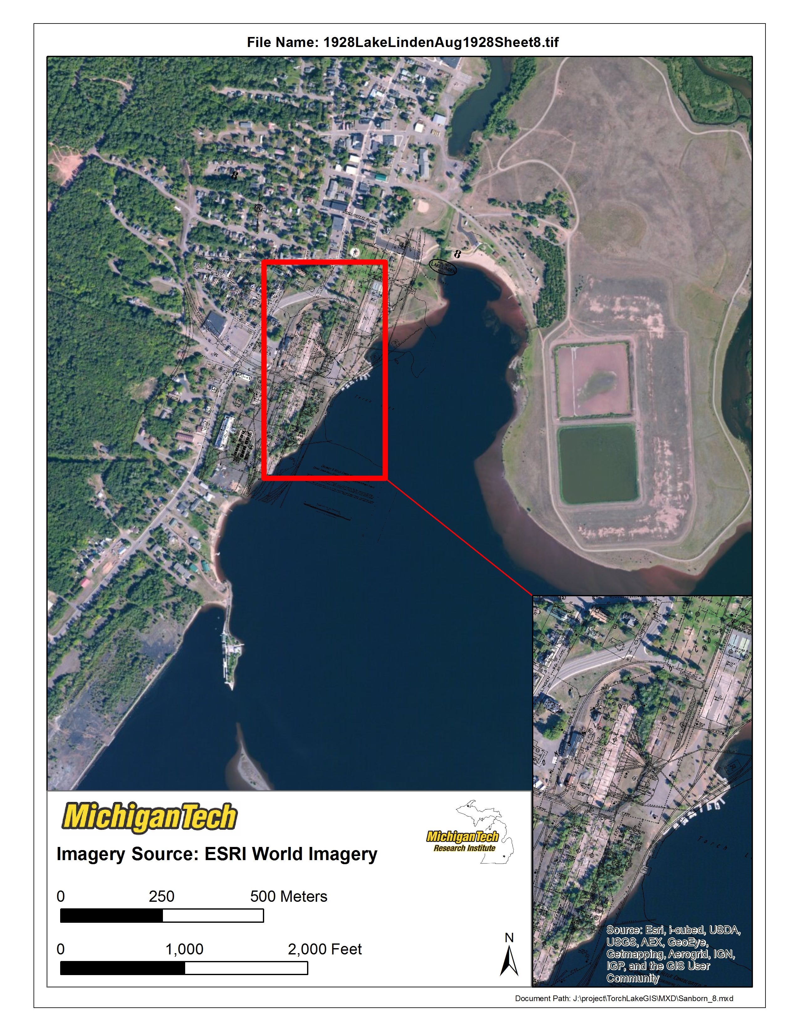
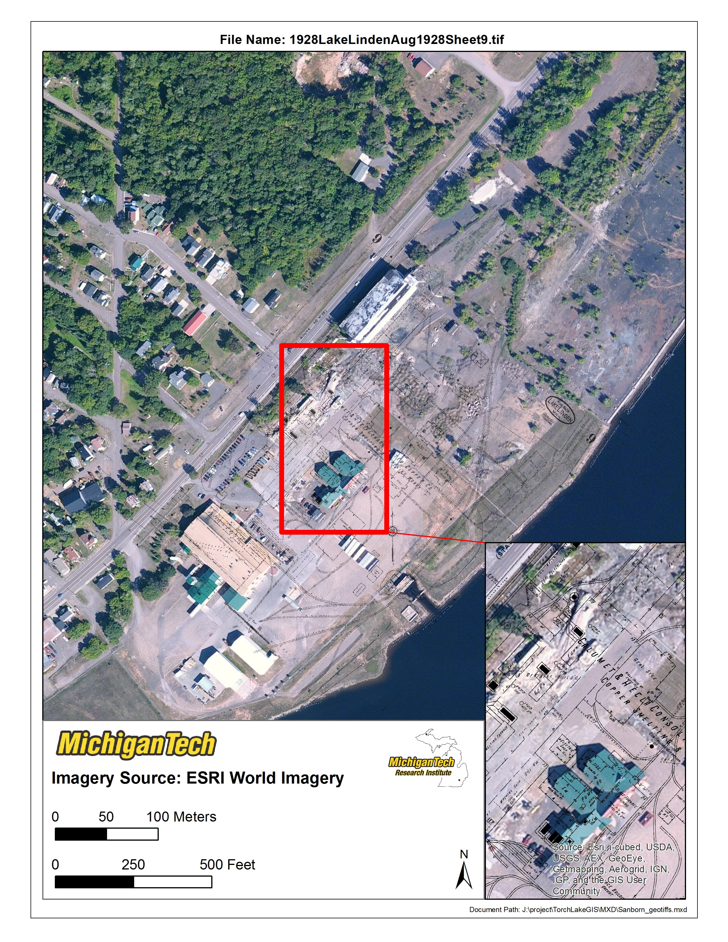
The overlayed Sanborn maps found below (black lines only) detail building activity and contents in the Lake Linden area during 1938. Sanborn maps were originally produced to estimate fire insurance risk, though, they are now frequently used as a critical piece of data by historians, industrial archeaologists and those attempting restoration efforts.
[ezcol_1half id=”” class=”” style=””]
[/ezcol_1half] [ezcol_1half_end id=”” class=”” style=””]
[/ezcol_1half_end]